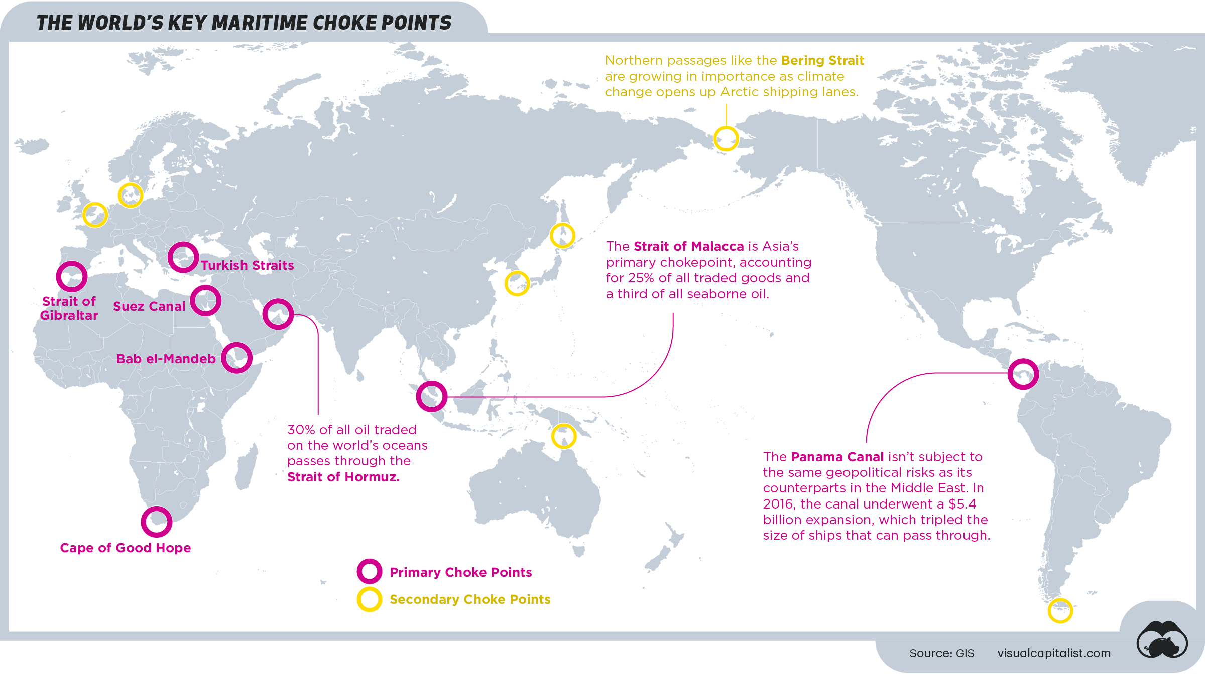
Mapping the World’s Key Maritime Choke Points
Maritime transport is an essential part of international trade—approximately 80% of global merchandise is shipped via sea.
Here’s a look at the world’s most vulnerable maritime bottlenecks—also known as choke points—as identified by GIS.
First published: March 30, 2021 (link)
Source files included: .ai, .eps, .pdf
Data source: GIS
A full license grants you the permission to download and modify our visualization, and to re-publish it in most professional and personal use cases.
Licenses also give you permission to translate our visualizations into another language, provided that you also remove the Visual Capitalist branding.
| Type of License | Full License (1 Credit) |
|---|